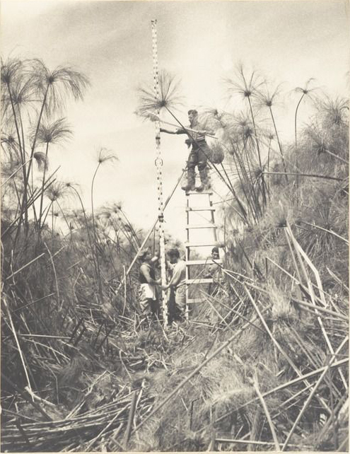
Initial Surveying in the Hule Swamp, ca. 1938. Source: The National Library of Israel, file ARC. 4* 2092 / 0514 Lenkin Family Collection.
See Shir’s project.
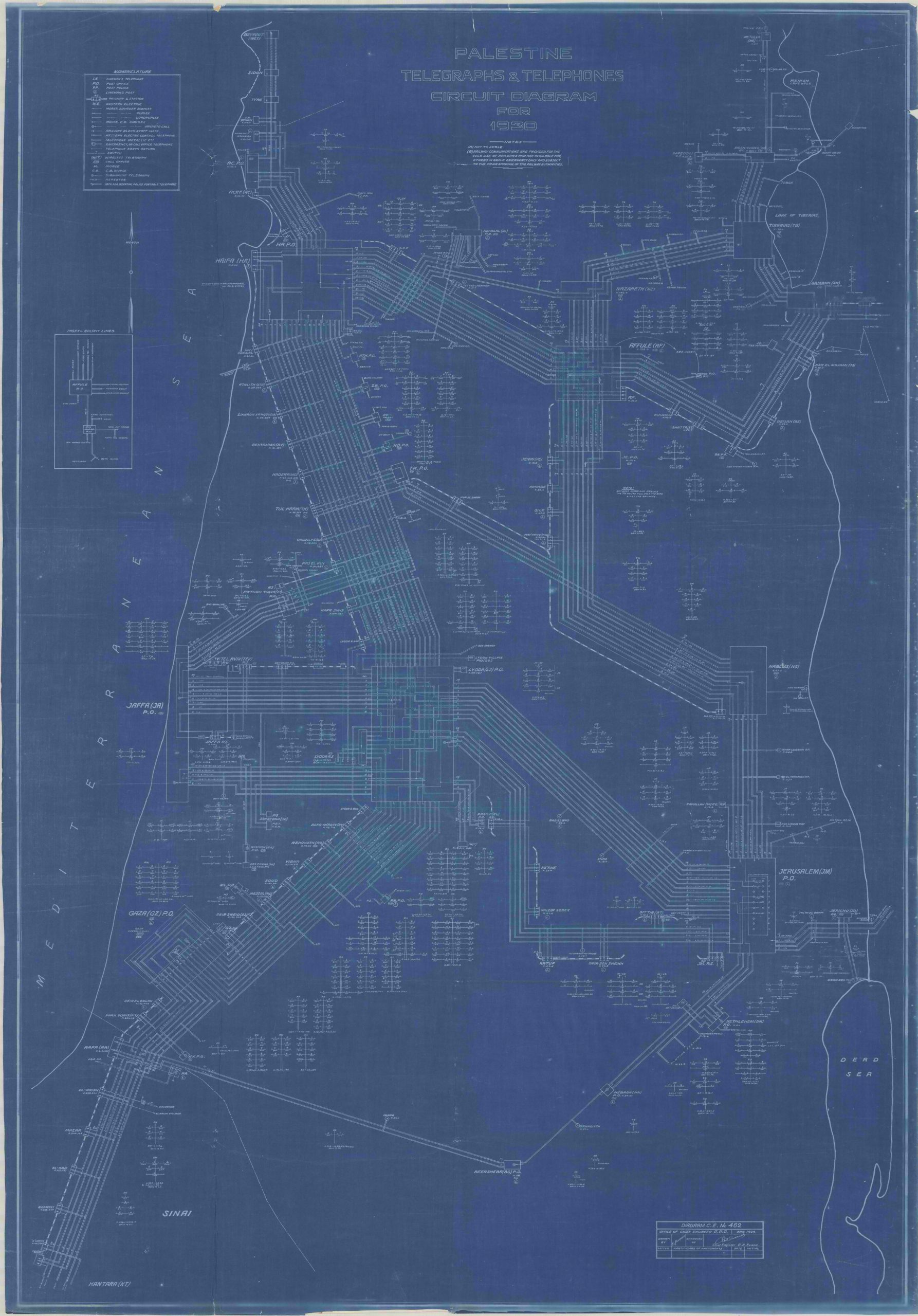
Telephone and telegraph circuit diagram, 1930. Source: Israel State Archives, file n 6751/1-MAP.
See Yara’s project.
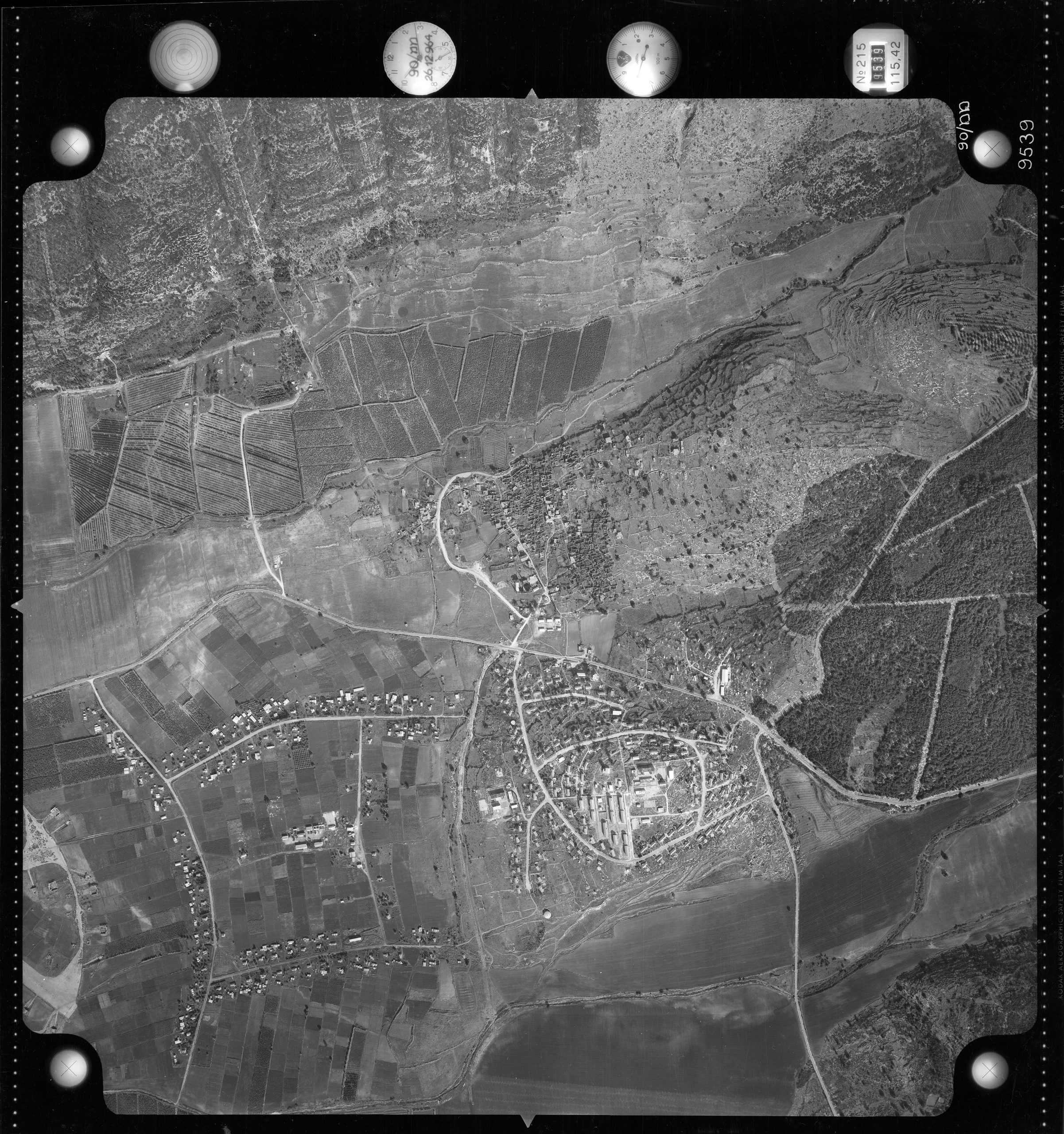
A 1964 aerial photograph of the ruins of Al-Bassa village alongside the new settlements of Shlomi and Moshav Betzet. Source: Shlomi Local Council. See Samadar’s project.